“Some parts of the I-95 corridor could reach 100 degrees Thursday afternoon with oppressive heat indices ranging between 105-110 degrees,” the prediction center said. The heat index factors in humidity with temperature.
Highs Wednesday afternoon will feel like 106 in New York City, 107 in Washington, DC, and even 98 in Boston. Actual temperatures in New York will be in the mid-90s and not drop below 90 for a high until Saturday. Washington, DC, could hit 100 degrees on Thursday and not see high temperatures get below 90 until Sunday.
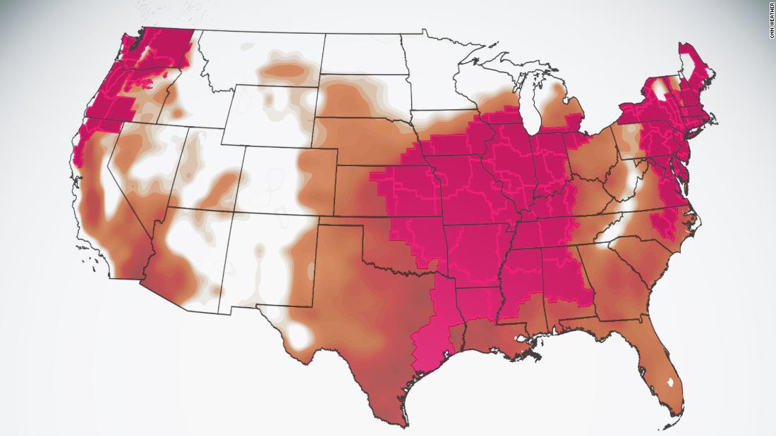
Pacific Northwest faces another round of heat

Across the West Coast, the heat will be building, especially in the Pacific Northwest. Temperatures there will soar 15 to 25 degrees Fahrenheit above normal.
“Temperatures on Thursday will even challenge some daily record highs in the Northeast and the Pacific Northwest,” the prediction center said.

Seattle’s record for the most consecutive days at 95 degrees or higher is four, and if this week’s forecast holds, it will reach five. In Seattle, climate records have been kept since 1894, but when it comes to August, 15 of the 31 days this month have a daily record that has been set in the past 12 years (2009-2020).
Scorching in the South and Midwest
The Mississippi River Valley will face temperatures in the upper 90s for the next several days, with heat indices feeling like 110 in some places. Places like Chicago, Houston, Memphis and Little Rock, Arkansas, are all under heat advisories.
Chicago will have highs around 90 on Wednesday and Thursday but feel closer to 100. Houston will also be sweltering in heat and humidity, with the heat index making temperatures feel like 110 the next two days.
Quite a few record warm lows could be broken across this region Thursday morning, too.
Severe weather possible for millions
Along with the heat will come a chance of thunderstorms for portions of the Midwest. Another round of severe weather is forecast Wednesday, with a level 3 of 5 risk for Chicago and Milwaukee. A level 2 of 5 threat includes Detroit.
Damaging winds are the primary threat, but several tornadoes are expected again Wednesday. Over the last two days, there have been 20 reports of tornadoes and over 250 reports of damaging winds.