Significant severe weather is possible across the central US on Sunday
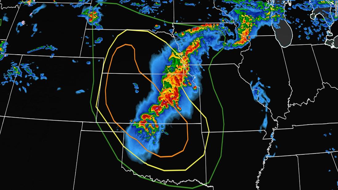
Potential threats include “severe thunderstorms producing very large hail, intense damaging winds, and a few tornadoes,” the center said, beginning Sunday afternoon and lasting through Sunday night. Heavy rain will also be associated with these storms, which could prompt localized flash flooding through Monday evening.
“Worst-case scenario could still support a derecho occurring this evening into the overnight somewhere in the region,” the center said, referring to a wind storm associated with a fast-moving group of severe thunderstorms. Derechos can cause hurricane-force winds of 74 mph or higher, tornadoes and heavy rains that could bring flash flooding.
While Oklahoma, Kansas, and Nebraska will be the bulls-eye for the worst severe storms Sunday, the broader severe storm threat encompasses over 15 million Americans from South Dakota to Arkansas, including Rapid City, South Dakota; Lincoln, Nebraska; Kansas City; Des Moines, Iowa; and Springfield, Missouri.
However, the severe storm threat does not end Sunday: Severe storms will remain possible Monday and Tuesday across some of the same locations.
On Monday the severe storm threat includes states across the central Plains and into the Ohio River Valley, where damaging winds and hail will be the main hazards. And on Tuesday, yet another round of strong to severe storms will threaten the central and southern Plains.